Google Earth meets online charts

Loren Beach

O34 - Portland, OR
Senior Moderator
Blogs Author
The URL closed my browser application three times running, when I tried to go to the site address. "Demo" indeed! As we sometimes say about new apps: "Beta Wait."

:rolleyes:

LB
 

Loren Beach

O34 - Portland, OR
Senior Moderator
Blogs Author
Bob, Not our "apple" hardware, but software is probably the reason... We are still using the old G4 with the 10.3.9 OS version, running Safari 1.3.2, for everyday surfing and writing. I really should get transitioned over to our new iMac with the newest OS and Safari versions.
As you might suspect, I have found a few other sites with JAVA that does not like my older browser version, either.

Being lazy, I figured that as long as all the banking and business connections worked, I could delay updating.
Charting (and boating related stuff!!)... now that IS a reason to update!
:)

Regards,
Loren

(Now Ethan will probably log in and explain why changing to Linux would solve *all* my problems!) :egrin:
 
Last edited:

JohnK

Member II
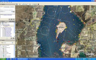
Here's another company that's married Google Earth and NOAA charts, EarthNC. There's a demo chart on their website you can try out. For 50 bucks, they provide all 600+ NOAA ENC (vector) charts for G.E. I'm not sure if it will replace chartplotters any time soon, but it's fun to play with! Here is a screenshot of Dutch Harbor, RI:
 

Attachments

  • jtown.jpg
    jtown.jpg
    129.5 KB · Views: 67

jmcpeak

Junior Viking
That is a great idea! So much information available today.
You should still know how to use a sextant, but mariners should consider how to use a computer and where to find information just as important.
 
Top