Chesapeake Bay cruise trip: New Bern, NC to St Marys City, MD

jtsai

Member III
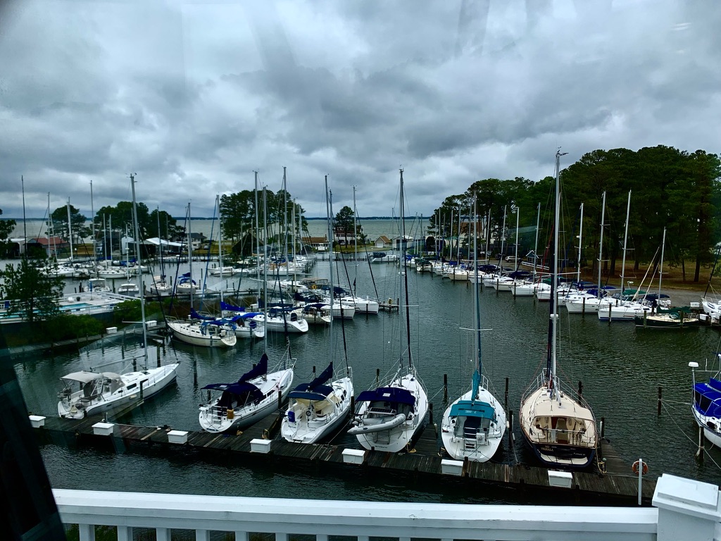
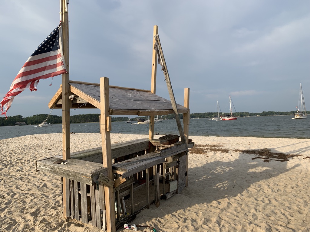
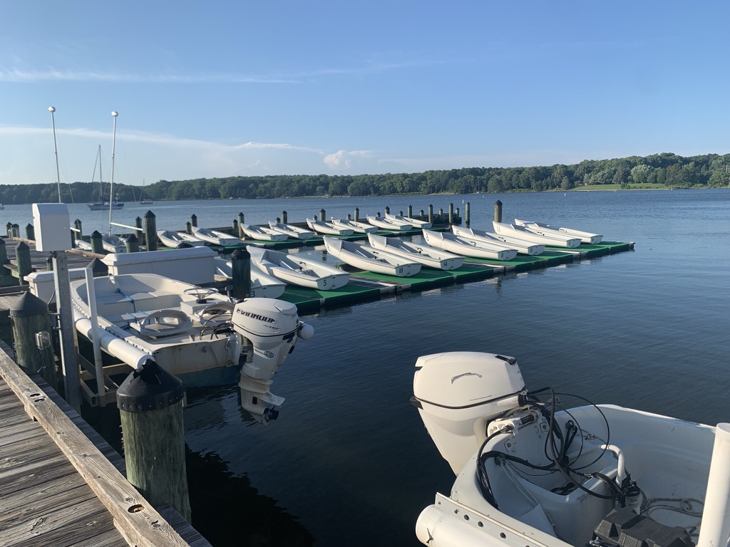
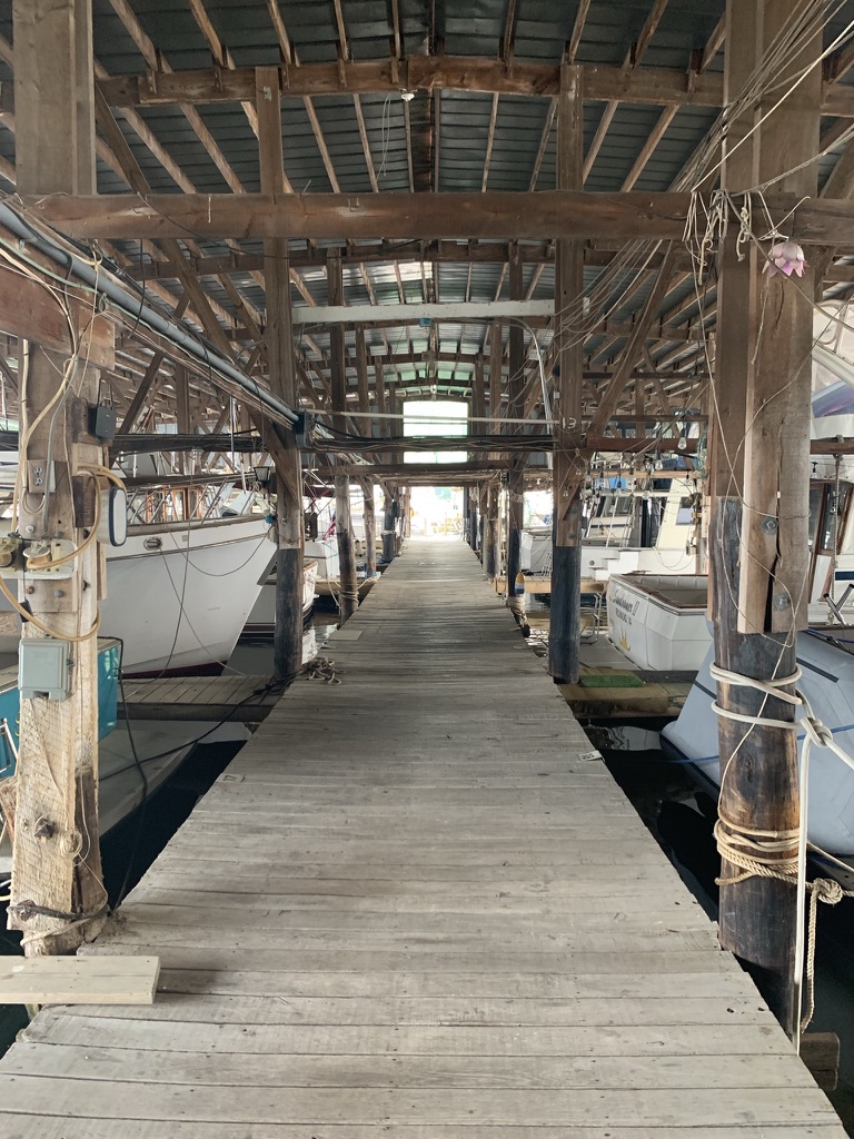
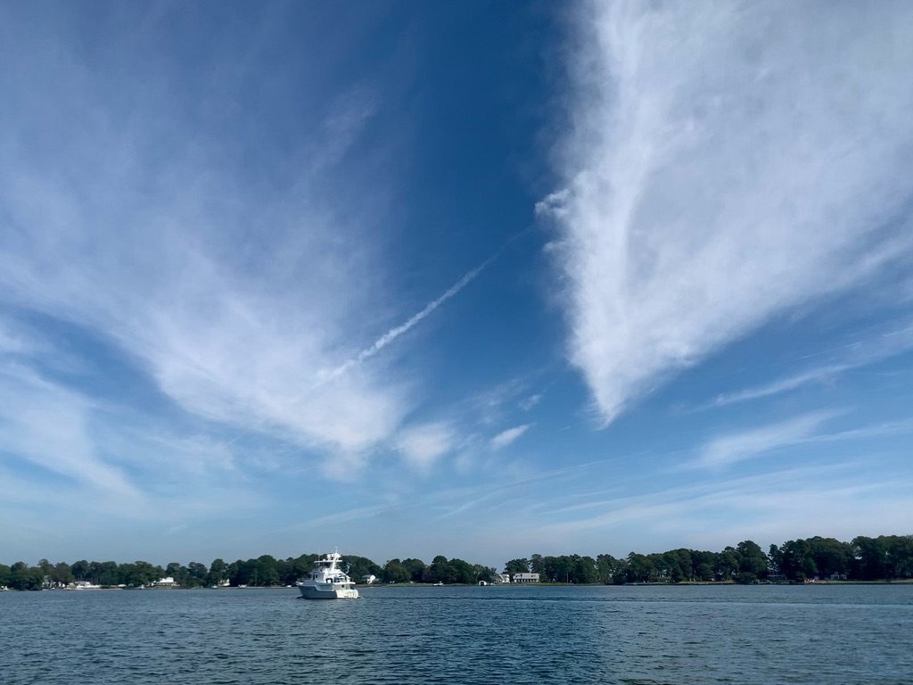
In summer 2021, I gave myself a retirement present to explore the Chesapeake Bay. A supposedly month-long trip turned into a 6 month stay at the Stingray Point Marina in Deltaville, VA. I did not sail further north than St. Marys City, MD at the northern shore of the Potomac River. Some of the more popular sailing/tourist spots such as Solomons Island, Annapolis, and St. Michaels will be explored in the future.

This was my first long distance solo cruising trip. I spent 40 days on the water (not consecutively), traveled 640 nautical miles, accumulated 135 engine hours, and lost 5 pounds (the most expensive diet plan?).

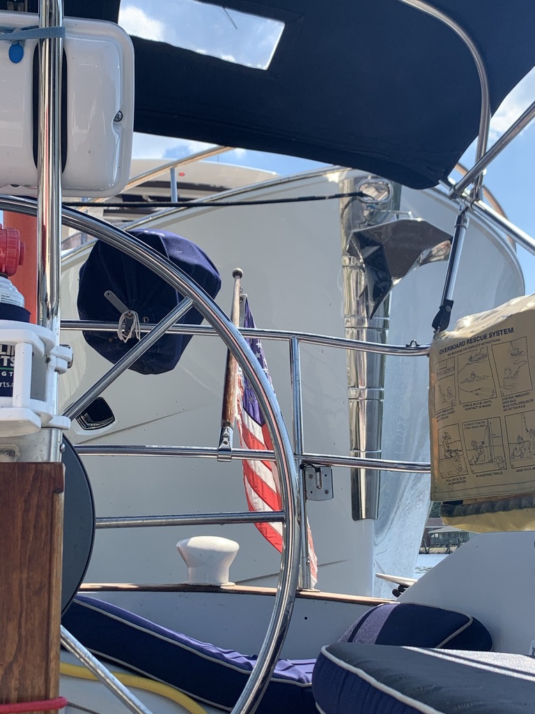
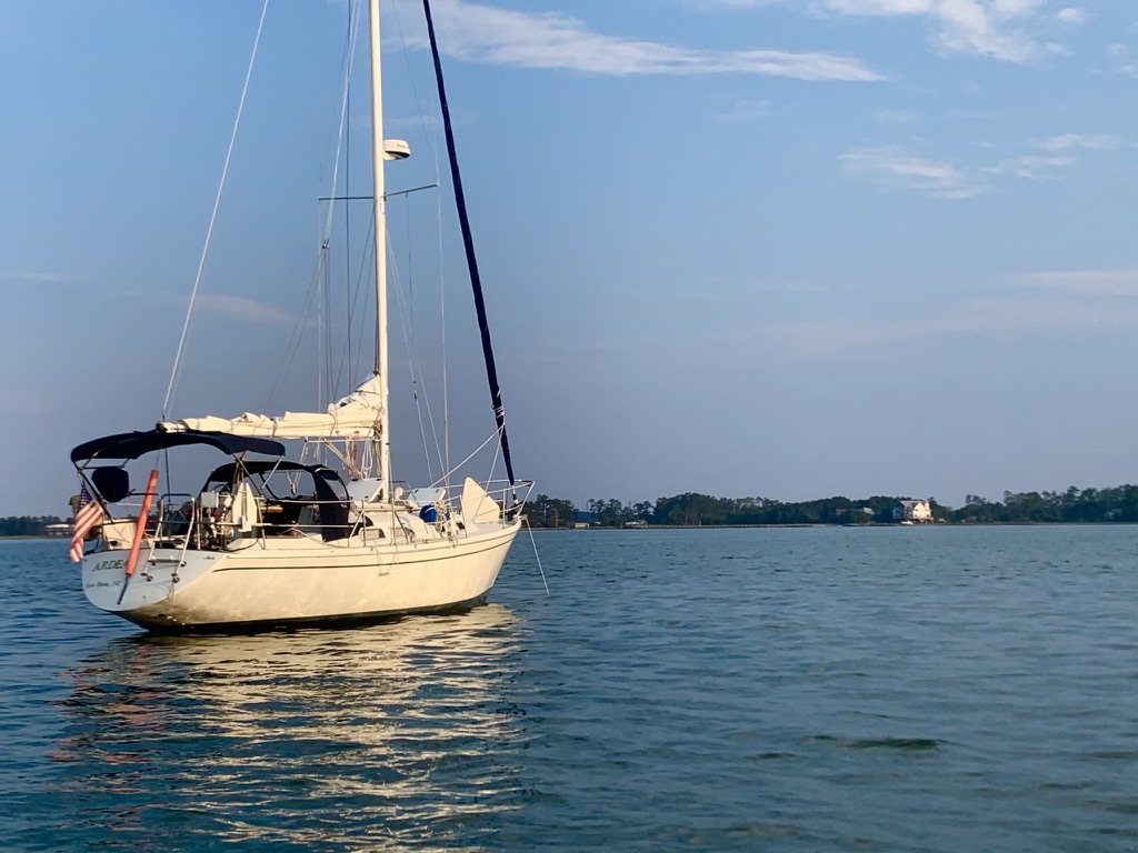
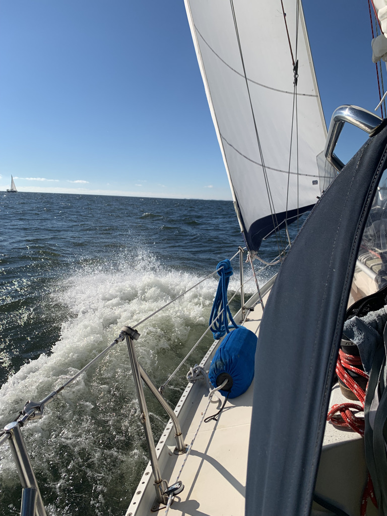
Ardea is a 1990 Ericson 32-3. She is equipped with shoal keel (4’3” draft), spade rudder, Universal 25XP (23 rated HP), 110% roller furling jib, and mainsail with lazy jack lines. She carries a Rocna 15 (33 lbs) anchor, 30’ 5/16” G4 chain and 150’ rode (no windlass, ouch!). The dinghy is an used West Marube inflatable stored in a bag hog-tied at the foredeck when not in tow and is propelled by a 3 hp 2-stroke outboard.

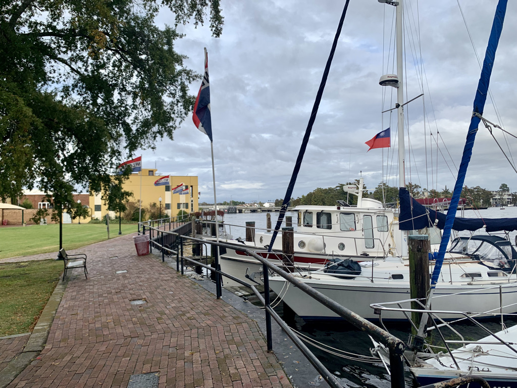
Stop #1: Shakedown trip to Oriental, NC

Ardea is not totally ready for this trip but I slipped away quietly from my home port at the Blackbeard Sailing Club in New Bern, NC. One of the unfinished repairs was a leaky anchor well drain tube. The drain hole is merely 6” from the waterline and the compromised tube allows water in the bilge during choppy conditions. After attempting to repair it twice, I closed the drain hole with quick epoxy from outside until finding a more permanent solution.

I had a nice easy sail to Oriental and tied up at the town dock in front of the Bean’s coffee shop. Many years ago, a few old salts would sit on the Bean’s front porch facing the town dock and raise score cards to rate incoming boaters’ docking maneuvers. They are all probably napping or no longer around.

After sorting and repacking provisions, I discovered water in the bilge. After a courageous “taste test”, it was determined that the source was from a cracked Whaler foot pump housing that kept squirting fresh water when the system is pressurized. I swap it with the salt water pump which I will not use during this trip. I can already tell this trip will require some attitude adjustments. It is true when they say “If you ain’t fixing, it ain’t cruising”.


Iy8V70wb_BNXuAQkDL6ZnSaCWD_QzZAjV4qSThe9uQoNYk4Bl7GrUvg4qaKk38Leal0SP0cp_xxJwgkhRkT4Km1zzerbfRD9_v4GsDq5AiyPntraMgsv8cwu7S56YhfZy1CyjahluEyV


Stop #2: Eastham Creek off Goose Creek near Pamlico River, NC

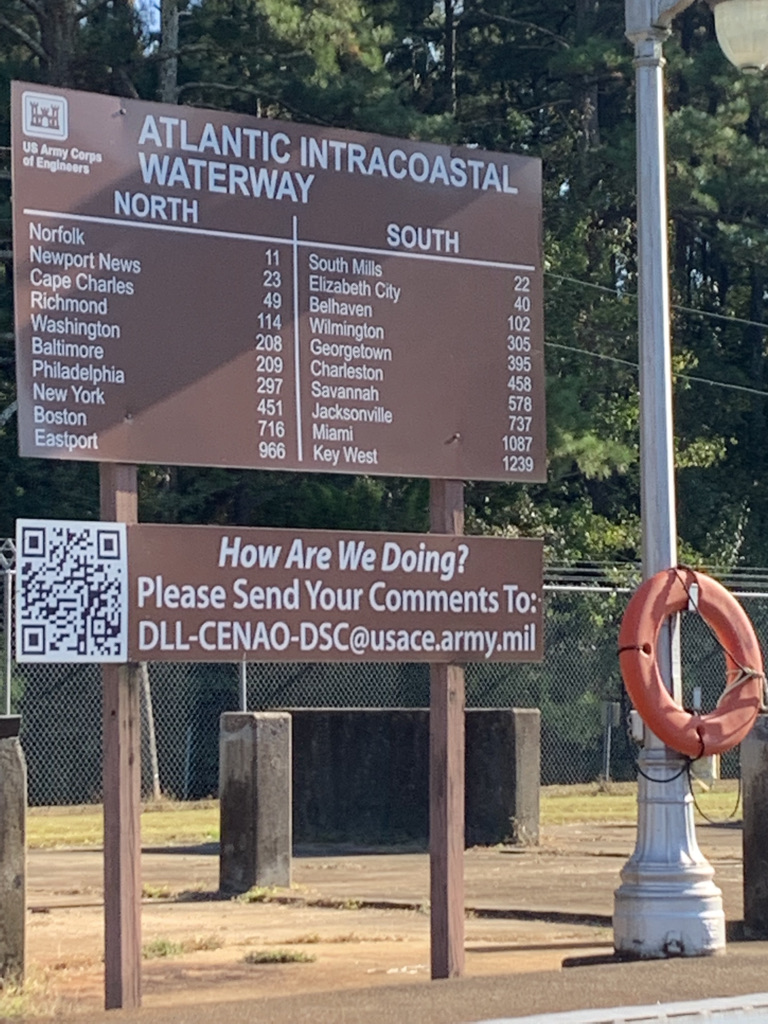
The second day we entered the wide open Pamlico Sound, rounded the Maw Point shoal, crossed the Bay River to the section of the Intracoastal Waterway that bisects North Carolina’s low land area.

We found a quiet anchorage at the Eastham Creek among crab pots. It was at this anchorage 10 years ago that some of my so-called “friends” introduced me to the movie “Deliverance”. I have yet to recover from that ordeal.
Had a chat with a fisherman checking his crab pots. He sure has a thick accent, but he probably thought the same about me.

Q6-E3c7vRUv28IvhsFGlZB8V4eUaFe-UEuv2WfnyH5usIMzI73lff-Lvuo66JjiS50cNypErlwProgwCIIZcfLW0gw3bPIujA5hq3YeAvZZiF_rStZigbITiOM5vqUgS_7ZOH3STnVT2


Stop #3: Dowry Creek Marina, Pungo River, Belhaven, NC

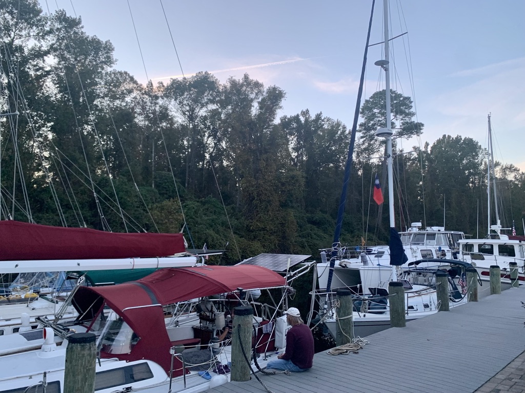
Today we crossed the Pamlico River into the Pungo River and stayed at Dowry Creek marina at the mouth of the Alligator River/Pungo River canal. Dowry Creek marina has to be one of the best marinas for the price in North Carolina. They have friendly staff and clean bathrooms with fluffy towels. After my first shower in 3 days, I smelled better and felt better too. No one to impress though.

Despite running the engine during part of the trip, frozen food is thawing out sooner than I can digest. Without solar panels to recharge the batteries and running the refrigerator full time for the third day (draws 4.5 amps), the house bank batteries (pair of Group 31 AGM) are asking for deep charge. Data on energy consumption amperage was one of the things I wanted to collect during this trip before investing in solar panels or upgrade the alternator.

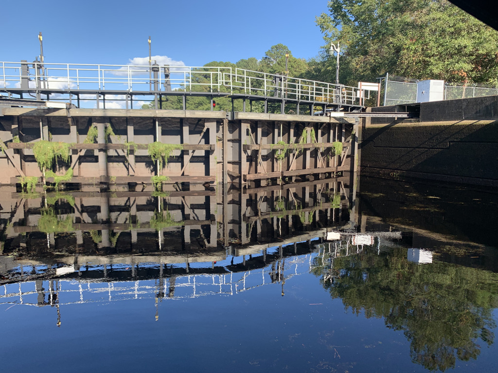
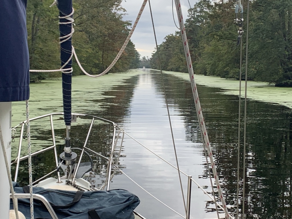
Stop #4: Seeking shelter at the Alligator River/ Pungo River canal, NC

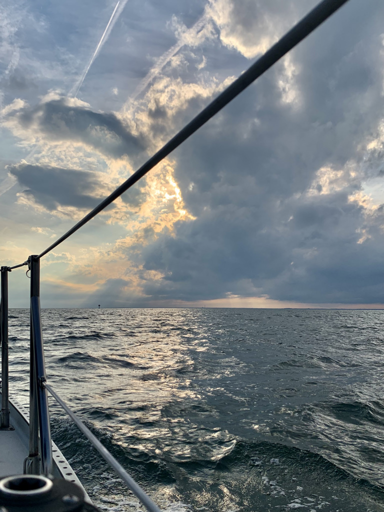
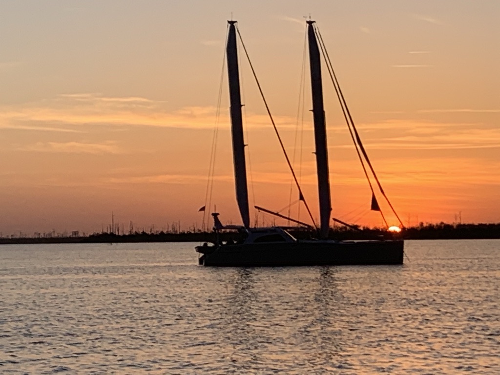
After an uneventful motor trip through the 20 nm Alligator River/Pungo River canal, we were confronted by 20 knots headwinds and 3’ chops in the Alligator River. I was impressed by how well Ardea managed the waves with little fuss; no pounding and sure-footed steering. However, with the engine running at 2,500 RPM I was only able to achieve 3 knots and it will take us 5 hours to reach the next anchorage, well beyond sunset. We turned around and dropped anchor at Bear Point just inside the river entrance. Seven other sailboats joined us later that evening. A big cat with twin wing sails dropped anchor near me.


j3qe96Ad0xuM76I0pSM-XvyclYipbl5k4uEtZuCOL9Lhjeh9QDnhh0t4vLvTWrBVMb33udbwlnhKZfYpodQtSLeu0RFzhZq__iaZhHVjuJ0mXz1P7c3nb2O7ClW0lJ1gPyDM22x9taA2

hFKNPSk387n8YTm1adAuvp278o2gMu2RzMEDgewE2zZs3NVtMRNVRTvklD0vdiY3sM6zIbHnqwpWg-73B1eBuMkE5c67haN87Q3oEbc67a-yfjO7WuYqp1rlMRiRSh80SfNfBnVtCwhH


Stop #5: Camden Bay off North River, north of Albemarle Sound, NC

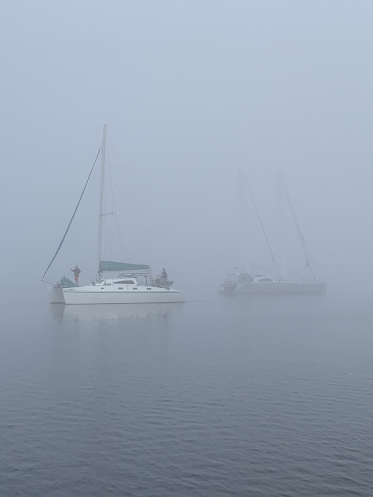
This morning’s departure from Bear Point was delayed due to thick fog. The sun burned out the fog around 10 am but the wind was a no show. We motored slowly northward in the Alligator River with several boats like ducks.

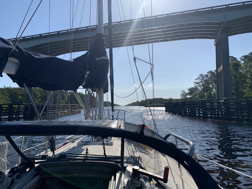
After being greeted by the friendly Alligator River bridge tender and weaving our way through a thick field of crab pots on the Albemarle Sound, we dropped anchor at Camden Bay early afternoon instead of continuing to Coinjock Marina.

It was a peaceful anchorage until someone started a generator. Oh wait, it was not a generator, it was mayflies swarming. I peered out the companionway and saw every square inch of the cockpit canvas was covered with mayflies. I locked myself in the cabin for the rest of the night.

43OBaKNtDiaHEtILA-X7kb6h1zsqCJnAW9Vlm26MOqq3PFQYNmXQAS8rCn_tj5B2CqdLo-EbFtwVKiyvdAv-yGHWisz30p1x2B5tYAdW1FQ3cLgGvdo3ST2nQTsrGKQauv3CBZLvzz70
 
Last edited:

jtsai

Member III
Stop #6: Coinjock Marina, NC

The talk of the marina boaters was mayflies. Most mayflies die after they finish whatever they do the night before. In addition to the carcass, they leave behind green juice that is difficult to wash off. Well, this is the month of May after all.

Coinjock Marina has wharf style docking and the staff know how to pack boats in. I watched nervously as the staff guided a huge yacht with its anchor inches from Ardea’s stern.

The marina restaurant has decent food. I had a nice dinner and fed Ardea 5 gallons of diesel. The Universal 25XP consumes 0.45 gallon per hour. Another data point collected.

7NanwU0x9eiUNdWJSwlnOartyUm_phJp4WSU0Ub0wp0yt8xYe5dmHu9tTfpEzHULqL9BsAgx7ska-ftIp1n1xA4iUezoKXIpi9cUSoDsr65aUxvVpAnfnqStP9jIcMLmeHw0bFOf3zJX


Stop #7: Hospital Point, Portsmouth, VA

Traveling from Coinjock to Portsmouth is a long day of motoring covering 45 nm and there is no easy way around it. We started early with several other boats heading north beating into strong NE winds on the shallow Currituck Sound. I was able to fly the jib to gain a bit of windward momentum and to settle down the motion but it was unseasonably cold for the middle of May despite the sun. Very glad I have a dodger to shield the wind and spray.

The Albemarle and Chesapeake Canal has one lock and four lifting bridges. The Great Bridge lock is built for barges and I struggled with a huge dock cleat high above my head. Good thing there was plenty of space between boats for the errors of solo sailors, it took me three tries. The four bridges are not far apart and communications among boaters and bridges step over each other on the VHF. It is important to know the bridge name here and switch to channel 13, otherwise you will be corrected sternly. The bridge opening schedule is 30 min. apart and the distance between bridges requires boaters to maintain 5 knots or you will have to do donuts in the narrow ICW for the next opening. No time to relax.

We arrived in the Portsmouth/Norfolk area fairly late and barely made the last bridge opening of the day. The scenery changed from lush green canal banks to military gray as we approached the Portsmouth/Norfolk area. Military patrol boats guarded the aircraft carriers in the boatyard. Their binoculars studied me as I peered through my own pair of binoculars. Mile marker 0 marks the beginning of the Intracoastal Waterway.

Arriving at the Hospital Point anchorage near sunset, I throttled down the engine, put it in neutral and went forward to deploy the anchor. The rather spirited upwind trip this morning torqued the anchor shank and jammed the release pin. Soft toed boat shoes did nothing as I kicked it repeatedly. Out of desperation, I grabbed a winch handle and knocked it loose before we drifted into other anchored boats. There were less than 10 boats at the anchorage, Ardea was the smallest one.

LpLqO5QytDiwxV54BCRp8TsmvxdhLQFnNJhehk_hMOKtZogPQXLIUb2snsKx-die0baMbH10NYLxlLo2NRWJed-lGbhhOaE7n9g4DRMMboL_80G55D3Tn31qZWWy9ANvwm_Fr_coXSQ8

SIq8_9ammOz1M7zokgY6-hhgKTlErQn3Ochh1FbymvNzYZFLQt0wr4WEWwspYTepSGbSUqJ26dB9S6Bc2pNUutEtOmh0CJ_IHTkwu8-_Ch6xxWCJ3aOCxd4iBD2tn62MfeCNAhALrFcJ


Stop #8: Provision day

My day went something like this:

9 am: inflate dinghy, mount outboard, crank, crank, crank, crank, finally started after about 15 cranks.

10 am: dinghy to Tidwater Yacht Marina, pay $20 to tie up with access to shower, laundry and WiFi. Walked 1 mile to grocery through historic Portsmouth
12 pm: return to boat with 25 lbs. of groceries, mostly canned food
2 pm: dinghy back to marina with a bag of dirty laundry. Mostly dirty I think, no longer able to tell dirty from clean
3:30 pm: return to boat with clean laundry
6 pm: dinghy to marina to unload trash and take a shower

I feel like a real cruiser after today’s experience.

23TLuW7WSVmQ-2CAd0awlxFN5oPyepCQz0t_f0vaOJvi6vCeTo_OJweeRxSuU91Q1wN3y7cVZVhGJ8BM7PEIRua7Go3NbW5f1qsCZ8w_lKTnzhuT6ZmCcOSjQH3moFe71EhWei201And


Stop 9: Severn Creek, Mobjock Bay, VA

Ten years ago, I had a bad experience with a freighter in Hampton Roads/Norfolk waterway so I wanted to depart Hospital Point early to beat the water traffic. Within 10 minutes after departure, the engine stalled. We limped back to the Hospital Point, dropped anchor and restarted the engine after bleeding the fuel system. Somehow the fuel system loses its prime occasionally, but not all the time. This problem persisted and was finally solved before making the return trip to NC. It was the check valve inside the Racor filter.

With 10 knots of wind and 1.5 knots of north setting current, Ardea sailed at 6.5 knots under a warm sun. There were lots of jet actions from Langley AFB in the sky, in the cockpit I was attacked by small black flies.

I dropped anchor at Severn Creek in Mobjack Bay early this afternoon. I jumped in the dinghy and explored this lovely creek dotted with expensive river houses, and finally felt relaxed for the first time since the trip began. Instead of making miles on the ICW daily, I now have more options for daily destinations. Spending 8-10 hours a day behind the wheel is not much fun.

That evening we saw a super moon rising with thunder clouds skimming over the horizon. The bay sure can generate some impressive thunderstorms.

FXLhzZzCFFt-esQsnyK-DuDAdwh3zAoZkrSTI-IRPUfX_NXroCPKeBENjsqU_9bZVvSJWTFkaKAoFAMcE0XpJguo_BOTSWLIuhC_e9ooOkmDNgtLlzgxcECO3p4sLd0koJ9UXDve_hPy


lSGA1Vce4Xl8bYvcouwNAWGrd0NqckDliLBsNyiNurxy_qbqL5fFsg54JCwDaQ7UCSb0s1oGrcee7L7hLOgKatRS3nTXMAUQaL5RCuZAV9Ri_XvPWTLS2O_iGpMNOUczmd4_zLTggBtg
 

jtsai

Member III
Stop #10: Stingray Point Marina, Deltaville, VA

Thanks to the sailing club reciprocity privilege, I secured a transient slip at Stingray Point Marina Yacht Club. I was very glad I made this decision instead of anchoring out in a creek. The Memorial Weekend northeast brought heavy winds and unseasonably cold temperatures. The Chesapeake Bay has a long fetch, from its N-S axis, it is roughly 4 times longer than the Pamlico Sound but with much deeper waters. The waves are akin to ocean swells but at shorter intervals. For fun, I recorded the water condition that weekend at the Stingray Point buoy; it blew 40 knots with 8’ waves.

Wearing all my t-shirts and the only pair of long pants to combat the unusually cool weather, I explored this one-road boating friendly town on a loaner bike. Deltaville is bordered by the Rappahannock River at the north and Pianakatank River at the south (took me months to learn how to pronounce these names). The town has more than a dozen marinas and several boat yards capable of lifting large vessels. This area was THE boat building center of the Chesapeake Bay when skipjacks plied the bay. The workforce remained in the area and made this a popular place for cruisers seeking repairs and parts.

After 10 days on the water traveling solo, I have reached the lower Chesapeake Bay. My time is not unlimited due to onshore obligations but it would be a shame ending the trip here. I find Deltaville charming and have made few new friends. The marina is well protected with easy access to the bay and rivers with abundant cruising destinations. In addition, hurricanes rarely visit this area and NOAA is forecasting yet another busy hurricane season. With these attributes, I leased a slip for 6 months and became one of the marina tenants in Deltaville. There are several boaters in the marina who live in North Carolina and I was able to find a ride back home.

3xpeTiwx77_8CIdOfKjPow4kEm0yijF-U6bKY8oJyrsalW2NbiZy3mc1rT1cF51f9lMI9JAh-_N-Bid50NBgIRWMaWA0_eeSYocHLv2WJQrhJCO75aL2DcycZg4RiqFiF4GAIqRFcy1E

AumkZgcBODHqjfe63qHblwaPsyRdQnfbQQeXiC6FDKnJGIEFf-_xCoXZ6tIx6Ip18Mvj8BwFlCLMgaff_zr7gdCjFhjlezDROiuBEoKd9wG2CMcV3Q8jgnQ0p5w_lM0LDOCUPGmQAvva

wjC52hkFAACVrc3PJBdXn2sQ9pRNmneL3Gj8PnJUVhVDoY-8W4P8N9bDG-4GgFCX_XsRdVM7Eo-2JaPCEg-jpjhp-PjZCSQzp_o8QDI0b6DURE4TYHm9J_HxUjGoEOtGpP2_FUUKMVyf


Stop #11, Carter Creek off Rappahannock River, VA

I returned to Deltaville to continue the exploration after a week of rest. The Chesapeake Bay runs north/south with predominant southerly winds in the summer and northerly in the winter. When the weather on the bay is stinky, the tributaries that run perpendicular to the bay offer protected sailing grounds. The Rappahannock River is one of those protected rivers. The name is Algonquian and means “river of quick, rising water” and, true to its name, the river has currents and depth reaches 70’ at some places.

Carter Creek is the first tributary west of the 2-mile-long Robert Norris highway bridge that spans the Rappahannock River, connecting Deltaville peninsula and the Northern Neck of Virginia. The water depth shallowed quickly from 70’ to 15’ as Ardea entered the postcard perfect harbor with impressive river homes on top of hills. Under these river mansions, I dropped anchor a quarter mile from the historical Tide Inn’s private beach. The luxurious inn was built in 1947 and every bit of this resort spells wealth. I was entertained by the beach party’s band and watched electric Duffy boats taking wealthy guests out for harbor cruises.

nKgIQ9z5TjeKu6DLyGlvVaErOT4ru34NVVC6O26kqviYq7UOaa8fL3IQz4k7jLbUOwIZON5OHUm30MA5jePcUj1n-hNwT7FnbqzTD00AU17URUzy43QgZaFj9xQcUWwRwMJvTHIjeegS


Stop #12, Little Bay, off Fleet Bay, north of Windmill Point

A fellow sailor from the Stingray Point Yacht Club invited me to their summer party at the Little Bay. I followed their gorgeous Mason 43 out to the bay and under light SW winds we rounded the Windmill Point Light to the Fleet Bay. The Little Bay is a bay within a bay surrounded by hook-shaped Fleet Island and the town of Foxwell. The bay offers excellent protection with sandy beaches, which reminded me of a miniature Cape Lookout bight. I arrived late in the day and the bay was crowded with twenty plus anchored boats. Ardea set her anchor away from the crowds to give her some swing room to avoid any midnight surprises. With only 30’ of chain, she will have a larger swing arc than the bigger boats with all chain anchor rode.

The group set up some tables with food beside a tiki bar that seemed to have been maintained and expanded by materials found at the beach. One of the members custom-ordered a piñata shaped as a spikey Coronavirus, and we all had fun whacking it blindfolded. Under the gorgeous sunset, old friends got reacquainted and new friends were made.

The wind picked up overnight and became stronger the next day. The group departed to return to their work life and I stayed for another night.

Q_W_6F8vGTFyOihAtOI8pHT0s8zlLIPvFq1cSBxmoeN4BbkvyoLNz_niAE3TCA4q1DCL_PYQCP-rsoAWU5bkSHmU8GrzeVLbb7BCHv_2QhbMIf5Xl3mmpMVoeYSaqCL5WKDPo8_CRhLE

rtkPOABeJ0_L7rerPTRUxCQoQralniB-K1T0JZbiDtp14C0GcpNLkX15Cz_0AvKGkB1E8YdDgu6_CeVmJecpAUcqTteq2us9XfGAkHNcHu6fBQzXzbCRPPxExdty95sEieluoZ43jLKS

fMFflIy9zXlA8Quf5BgIuIrtbaFrL96X846AKSI8hAFsI6iXM2q7tsntEaqGZLL8i0_-6vtLREvEh-c3VC5daaI0oFVcDbB179m1XbD50HCNDcHrde8_mzotzXePUOi4urEyXiZXVYQz


Stop #13, Reedville, VA

Reedville is 20 n.m. north of the Little Bay, and it is home to the last menhaden fleet and processing plant in the US. The processing plant spewed aroma, and reminded me of the now shuttered fish plant next to the Lennonsville Point boat ramp in Beaufort, NC. The Fishermen’s Museum in Reedville is all about the fishing industry in the bay, especially the menhaden fleet that supported generations of the local economy.

SKXyw7WpgY7SYd8tUmL9zWy2naM-2crL3ec47LP79N6C6rQAfDyJ2GeIO2P_sUPSbgDPYlAT_gC89fyime8edm42Mn8iRU5TYSrF1yM4nMk1v7O2eOsLILcA9iU6EAWLFJ7Lv8SLEsUy


xwnksp7rFMe7G3qXPMDuGOiMKjzM2MEyUs3NWZ2Ebq9QDI1CKoBO6pN4cqW6wt7BbFcpLFcuyROnn8ZJdyNTCUkrkbps4KJQb6_LGlISguTr3LAUakPqYc6EHphElI2_JsFKs3Or6A3k
 

jtsai

Member III
Stop #14, St Marys City, MD

St Marys City, MD is 30 n.m. from Reedivlle, VA separated by the mighty Potomac River. The mouth of the Potomac River is 10 n.m. wide and flanked by Smith Point light at the south and Point Lookout light at the north. Local sailors recommended staying in the shipping channel and far away from shore to avoid the confused sea, and stated “it will suck” regardless of the time of day. With this advice, I took extra care to stow items in the cabin and hog-tied the deflated dinghy on the deck. To be cautious, I flew only the 110% genoa and moved at 4 knots with the aid of 1 knot current and light south wind directly astern.

Wind speed increased to 15 knots in the late morning and the bay rollers lifted Ardea’s stern and hurried us northward at 6 kts. By the time the Smith Point light was in view, the Potomac River’s south setting current found the north setting Chesapeake Bay rollers and entertained us with small whirlpools and square waves. I was mesmerized by the confused water at the Smith Point light then realized I had no business sailing in 20’ of water, which was against the advice from local sailors. The contrary currents generated short steep white caps that attacked Ardea from the north, collided with the 3’ Chesapeake Bay rollers from the south, with Ardea caught in the battle. I stretched legs on each side of the cockpit, arms wrapped around the stern pushpit and relinquished control to the autopilot. This lasted for an exciting 30 minutes, the cabin was a mess, and yes, it sucked.

Once relieved from the grips of those currents, the remaining trip to St. Marys City was quite enjoyable. The city was Maryland’s first European settlement and formal colonial capital. Now, it is a state-run historical site and home to the Maryland Dove. Ark and Dove were the two ships that began the Maryland Colony in 1634. I deployed the dinghy and landed at St Mary’s College sailing team’s dock. It was college summer break and the historical site was closed from Monday to Wednesday so I had the whole “city” to myself. I read during the non-covid times, boaters were welcome in the college cafeteria.

FLKqUafPRxeCccfmFWgLa5qgddiW6_wf5Gm4A19D_VlaGg6GXQqQHgK9hRE-vdk7qixIH18cNb6pf-oao3U2twPj2Afc2abp0K-fXsPORXmeLAt39PpT-Bo8W8c6zDfnA64qqz4PR8Q1

RUhj4A2ujIXL0-BXX2-hXz3UfBKGScyh2fl1cr8uddug0ucYmrMbEU41f2OdZsrvz0uM2DhB3y3PpEFCztFwXLs3eEaFVfhgiaTbbLvWStcV6RXIhyi10C-gzhv0YAIHvIozq-JKS1nr


Stop #15, Yecomico River, southern shore of Potomac River, VA

The horseshoe shaped bay at St Marys City was inundated with sea nettles drifted in with the south wind. Locals say they don’t hurt that much but I am not going to test that theory even with the 97-degree heat index. The Chesapeake Bay is now in its full summer weather pattern, hot and humid with daily afternoon thunderstorms. I sought shelter in Yeocomico River across the Potomac from St Marys City and found the quirky Olverson’s Lodge Creek Marina. The owner and his dad built the 5 docks, 200 slips marina plank by plank over the course of half a decade. Cost is $1.50 per foot, electricity included, cold AC and shower never felt so good!

UwhRGVdlh1wWKx4UU85Mrkyw7fVq4lf9sHLdqqVPRDlMuUyc0jEIUqYmWdTtwfNrX4CyCd5K8-dVGfMhUEFWjLjhnZAyUYK8-XSKfKGkMegoVUqH4fizaw_z19jJBlkNLfPztF1THMeR

ZYr1mkuCJbDlRcspnDlfVvLwW5XxOaz7iOPmZlUXL4CZGaVBk3hO6SJL7KUWn-jWfDG6MNPPZ55pt-2yrLFbvv3Noi6XhyXdNP8NQ4v1cOTBdhOZCSZwg3GnXxC-6_QMUrZXb8Dll9ix
XIFQcPCh9aGm-fmQR0JpMAvezHKMYKuDt9GcHy7uSF9z2KkjyA2ahyeT4ioEUNPM_OAOPvVbT-1pfwQtZcmbszea4yCGKYC9bSn0nEfR3fZFK8oMcjqbj3TwUTNKT0Vh3t_pMmwZokmc


Stop #16, Pianakantank River and Fishing Bay, VA

I returned to the boat in September and wanted to check the bottom, prop and the shaft zinc. I waited after the ebb tide carried sea nettles out the marina basin then lowered myself in the water from the stern ladder. I reached out blindly to feel for barnacles on the hull, but my curious hand landed on a sleeping crab. It awoke and bolted straight toward my mask. Startled, I took in a gulp of water and that was how I found the Chesapeake Bay water is quite salty. For dinner, I had a crab cake sandwich.

With a clean prop, we sailed out to the bay to explore the Piankatank River at the southern tip of the Deltaville peninsula. The river’s entrance is guarded by a 1.5 mile long sand spit that hangs from the peninsula, shaped like stingray’s dermal denticle or barb. Local history says this was where John Smith almost died of an injury caused from a stingray’s barb. Inside the sand spit is Fishing Bay, the water is 20’ deep all the way to the shoreline with excellent protection from northerly winds. I sailed further upstream to Wilton Creek where the river narrows and makes several corkscrew turns which makes a good hurricane hole.

T4GfLFTrOedPwJnlVDlcbWeo0oiGXczwjz1OWttwP2RNQyNRVdYAnKi64PVbnGk80c6YTsBXhSriBBZLfneIkfWyW2FJ-_IgFIziihsxjcJXLx0xLDBDy6zZEb3uAOmmTgfG8J0ClG4D


Stop #17, Mobjack Bay and heading south

By October, boaters in the marina began discussing winter preparations. Many are scheduling haul out and winter storage to beat the last minute rush, some will winterize and stay in the slip, very few will tempt the weather and sail year-round. A liveaboard at the marina says Deltaville turns into “Deadville" in the winter.

In late October, Ardea slipped out of her temporary home behind a passing cold front and joined the southbound snowbirds. The wind had turned to the north and the temperature dropped significantly. We started late so I only traveled 20 nm before dropping anchor at the north side of the Mobjock Bay. That evening under protection from the New Point Comfort Natural Area Reserve, we watched fierce thunderstorms that passed over the Hampton/Norfolk area. I planned to experiment the return trip without using refrigeration, so my diet became canned vegetables, tuna, chicken, spam, and ready-to-eat backpacking meals.


IADiHfmCY-iXip8YE09zPV_povoSeT3BYjrlyjsqPKojYHZc4W-WbsJebZhSHJqQ3OwPASqrWTsF7rXeSazUo7LI99bZ5AFfPpEIns5hKFhzPMFvMCMPrtEsycNNV0XamudBBBxnc-Za
 

jtsai

Member III
Stop #18, Deep Creek lock, the Dismal Swamp Canal

I woke up early to prepare for today's 40 n.m. trip to the Deep Creek Lock at the Dismal Swamp Canal. The morning air was cool and felt like fall. Boats anchored at the Mobjack Bay joined others in the bay, and we all shared the same southbound track with a sense of urgency. A northeastern was forming at the VA/NC coast.

The VHF traffic was overwhelming in the Hampton Roads area. There were Coast Guards, commercial ships, recreational ships, and military traffic. One call that caught my attention was about staying away from the submarine. I was under sail and was wondering: who had the right of way, a sailboat or submarine? A rather official looking boat approached and interrupted that thought, and I was close enough to see the gunman’s finger on the trigger of a machine gun. I acknowledged with a wave and moved out the way, and he gave me a half wave with the other arm, finger still on trigger. Glad I wasn’t flying a foreign flag this morning. Under my armpit, I held my phone and secretly took a few pictures of the passing submarine headed out to sea, it was quite large.

The Gilmerton railroad bridge was stuck in a halfway opening position. Boats began to queue up at both sides of the bridge either idling or making small circles. After a 20 minute delay, workers were unable to make repairs, and the bridge tender instructed us to take turns squeezing through the half-opened railroad bridge.

Due to the delay, we pushed the little diesel hard toward the Deep Creek Lock for the last opening of the day. The lock tender released a northbound boat exiting the canal then instructed me into the empty dock. He then closed a pair of gates, flooded the lock and raised Ardea to a nose-bleed elevation of 8’ above the sea level onto the Dismal Swamp Canal. We tied up at the town park past the lock and treated myself to a bag of beef stroganoff, it was a long day.

RwKpOalJpAaUBE-NueBrVPN0bnPp5RTddNvXvBGQIpIYvSy7yUc51k40EUyyVrz4v3dMPuSVk5aM7Ew-xIymXqpqEh73KV1wQQ4VjURlsS4wttTAfiMLu4-mmuigBu353qNRaaMqe8Uu

zMC0jLaoRuMryv1LDaplFy4TDrk7E_49ONDmhRHo2iZpn69Cdo0x-NB-UbPOlU9K0qpo8YrnpTLQc4B7r6q6zC2P8Cc9uV_8_WJGbeb0ocOl0YgZ4gGxvq7KqoBSf8j04NFcCvz3f3CK

uD15q3sOfYfduEv1OKAsfZTz_SJ5-8xxh5aXQn5kcNAoQJOMcUAREAcNpDy-_RKxPovcloBDFEiz1vtDDjv47_YBX4wV1Bas6t2Abp1klLOsshphCKXwNTkmHxWMzz5kr9hYI7euXxP2


B3FLpCMCf3V0I3qE_mwtpJFwRMA-eOmg97ZN4GfR0ASRag6ms_aAc8fF82dkVwwIMgIoy4IyYc67BnXxDfhlBIv7cQ4axSex685P2caYRhJQqngMCr5O686Esbrn8MaD_0aJKES3e_kd


Stop #19, Dismal Swamp Canal visitor center

Deep Creek to the Dismal Swamp Canal Visitor Center is a leisurely 15 nm run. With time to spare, I walked to town and enjoyed a sausage and egg biscuit with coffee at Hardee’s.

After construction began in 1793 and completed in 1822, the Dismal Swamp Canal is the oldest continually operating man-made canal in the U.S. Today the canal is operated and maintained by the U.S. Army Corps of Engineers. The waterway is as straight as a pencil and the only challenges were floating logs, low hanging tree branches, and duckweeds. I heard three thumps.

The Dismal Swamp Canal Visitor Center is the only visitor center in the continental US that greets visitors by both a major highway and a historic waterway. We arrived at the visitor center at 1 pm and by late afternoon there were 6 sailboats and 2 trawlers, double and triple tied. One of the sailboats limped in with an overheated engine due to a raw water sea strainer clogged by duckweeds. Two boats with French Canadian families flew their maple leaf flags, and I raised the Taiwan flag to add to the diversity.

na4WqYM0aY7tOqpznv0h-h74-FhZZO0yrbGkHXyRrtohHbW5iusay1X3lBI_ZQfnu38ErPmJzQmKyxsXeU8NgR3RtGSK6_Ml-F6mNyLsWabZhQ0WevynwVrYe7YBwB3bb85aTVi-X-ZP


Stop #20, Elizabeth City, NC

After a quiet evening, Ardea and two trawlers left the Dismal Swamp Visitor Center at 7:30 a.m. for the 8:30 South Mills Lock that brought us back down to sea level. We motored at 5 knots parting the lush green duckweeds under a canopy of early fall foliage, like traveling through a fairytale land. The narrow straight canal became the Pasquotank River and resumed its natural windy course. In the protected canal you would never know a northeastern was punishing the NC and VA coasts.

We docked at the Elizabeth City Municipal Dock in the late afternoon. The slips consisted of pilings and cleats on a concrete bulkhead with a small fixed dock that required a bit of gymnastics to disembark from the boat.

This was the fourth off-the-grid day. The house bank battery was content and could go for many more nights. I quite like this different cruising experience, where you’re not limited by an amp hungry refrigerator.

pWXK1TUfn5vHz5iLKFNWFCMh5wijl2qnveFHVJhnIN3qQaS9zktmol4SeL4XD0sR2a2aN9iZjCW9dG98sk8fA8-RT3bQF8c7lTinCaaBP3r9aZalPUdc4HGJMn1aFgfDFUZScG2o7Kb1


7oPGkYKIZkeRHC9lCxcgVnz4gEtX2WQLveV3y5zhOlYsqoEZ3VnO2yJ62OOzfOIvuCaexUad9dzxWbpMzjl5MkQdL5WhgqHGixGdSOAn0LCcQDN1l2S2i_IdWeFc5BtYMaDvnaPbcmVo


Stop #21, Pasquotank River, Alligator River, NC

All boats over stayed Elizabeth City Municipal Dock’s 48-hour limit because no one had the appetite to cross the Albemarle Sound in the last three days. The northeastern abated on the 4th day and blessed us with a favorable weather window. Boats have been queued up in Elizabeth City and Coinjock all departed early in the cold morning. A fast beam reach, we crossed the Albemarle Sound and arrived at the Alligator River bridge. The bridge tender was patient and held up traffic while waiting for slower boats to pass.

We finally had a sunny afternoon with gentle northeast wind. The Alligator River was dotted with over 20 southbound sailboats flying all imaginable sail configurations. Larger boats were in a hurry and headed for Belhaven, but Ardea couldn’t make it before the day ended. We tucked in Georgia Bay in the canal, dropped anchor, and readied for the forecasted storm with potential 180-degree wind shift.

A large sailboat arrived late that night and dropped anchor close to me. The wind strengthened to over 25 kts overnight and I woke several times to monitor the anchored position. The 33 lbs Rocna held well and the wind shift did not materialize.

W0p_qfIrHvpup_-vMMD-H-YyMotbU8iLDsjjIZzw83S3TaURY-3emExpQ8kRdJ98_K9d_HdEVIc4T_BiL8_Vg_dxsgtrfuXufKveE0FTPlYOYucZXDjgHWkvOJJCI08Wfynfrft_0jnT


Owu1dX8msqShsSMG_7XhlvHl_fO4mDLdpLzE41hFmkhkhlQO7fbOpYlwWs8ZTIkYiLStWLnlohC4DFOHqiECg_Pn7Rfz0IJ_lY9PTir8vbiHHxuLjIW4-pYbcWv6EgfwLMA1Bo_kzHpf
 

jtsai

Member III
Stop #22, Dowry Creek marina, Belhaven, NC

Navigating in the 20 nm long Alligator River/Pungo River Canal was straight forward except a squall lasted for five minutes that reduced visibility to 10’. Unable to see the canal shorelines, I steered with eyes glued on the chart plotter. The forecasted front took its time passing and Mr. Sun finally peaked behind clouds as we exited the canal and entered the Pungo River. The wind gusted to the upper 20’s, quite a contrast from the sheltered canal.

I was hoping for a slip in Belhaven to share dinner with new boating friends but all marinas in town were full except the Dowry Creek Marina that is few miles from the town proper. While motoring in the Dowry Creek marina fairway, the wind increased to 30 knts and the equally fierce beam waves rocked Ardea from port to starboard with 30 degree arc. I was inside the marina fairway and at the point of no return and could only throttle up the engine to maintain steerage. The dock master hailed for enforcement and directed me to a different slip. With the protection from three docked trawlers shielding the wind and my midship line always set up ready to go, we averted a YouTube moment. All fingers were accounted for, just a bit blue. I rewarded myself with an ice cream bar from the marina store.

Stop #23, Vandemere, NC

We were greeted with bright sunshine and warm southwest wind this morning. A dozen southbound boats motored on the Pungo River and crossed the Pamlico River toward the Goose Creek section of the ICW. Past the Hobucken Coast Guard station and Mayo seafood, we were greeted again with 20 knots head wind at the ICW and Bay River junction. Knowing the Neuse River would be uncomfortable in this wind direction, we took a starboard tack and headed toward Vandemere where Ardea called home for a year. We visited a friend in town and had a peaceful night of sleep at the Vandemere town dock.

6GtnPofmIfSejzhB-2ibAhr_O0O-pRpOvuy2nN1JlMcOj_cn43omL6jYO6uBx16FhD8NepZi9rUpKtIL1ws-1HnqOk-7AOdH84dJLoefYhn7aaDnFdhLtL5VcGHxViW0oyurQM5PIG5M


Stop #24, Blackbeard Sailing Club, New Bern, NC

We left the Vandemere town dock at dawn and sailed toward the Neuse River directly into the bright sun. Pushed by 15 kts SW wind, we rejoined the ICW and began the slow southwest turn rounding the Maw Point shoal. Several southbound boats were bashing directly into the 3’ Neuse River chops under motor, following the ICW magenta line toward the all familiar Adams Creek entrance. I put a reef in the main to ease the motion and was able to maintain 6 knots of speed toward the Turnagain Bay. I was again impressed how well Ardea handles chops. We tacked near the bay and crossed paths with those southbound boats outside the Oriental. Ardea may have traveled a longer distance than those boats under motor, but arrived about the same time and had more fun. I had plenty of food and water, and, for a brief moment, I thought about taking a port tack and following those southbound boats, perhaps next year?

With the Minnesotte - Cherry Branch ferry in sight, I started to worry about my arrival at the Blackbeard Sailing Club. I have been gone for six months and couldn’t recall my slip number and whether I had left dock lines on pilings. The dockmaster answered my email about the slip number but I will need assistance at the dock just in case there was no line to grab. It was getting late in the afternoon so I stowed sails and revved up the engine for the last few miles of the homebound trip.

We arrived at the Blackbeard Sailing Club in the late afternoon and got help at the dock. Old friends, warm showers and a real chair to sit in felt good.

I spent 40 days and nights on the water, traveled 640 nm and accumulated 135 engine hours. The trip taught me sailing (especially cruising) is an exercise of risk management. We go slowly in a fiberglass tub with underwater holes, electrical wires inches away from the water, and a 45’ lighting rod. Small engine burns dead dinosaurs and beats its heart out pushing this tub to where winds don’t want us to go. Relying on weather forecasts spit out in the form of 0’s and 1’, interpreted by someone in a dark room. Among all the risks, we somehow find the equilibrium between Bernoulli’s principle and hydrodynamic forces that we pretend to understand, yet the tub we called sailboat magically carried our dreams and adventures. It is just magical!


Luwo-Z-CB-UpwkTtHF3g2zPUzDUNpuXcceUd9mIxxuJOETUvpDx7uUIwEEgmRrcn-HEFqySqBvMq1vcYoarnusru5fykrouSXm2UHVpJPya-DEbNPeqBVjaRbXKC8lGe-NpAlDzubAdY

N_JlZz8kHNMELRABH-qqQkGR9v5IvxCKvrB7_aCosn5zTJrtVTgty0A7CLQJq3zsc-cpa4ItADBT3vo3gBCzvMxwXhBr0LDEMAfN0OZQJHBORbLd5swLqx_5hWnLsAVc-cGK0jf9Z36N
 

southofvictor

Member III
Blogs Author
I really enjoyed your report, thanks for sharing. Brought back memories of the two trips south I’ve made on the ICW. It’s such a beautiful way to see the eastern part of NC/SC - way more fun than the highway!
 

jtsai

Member III
Thank you all for the kind words.

Rick: I hope you are enjoying living in Oriental, NC, it is a special place. Do drop by if you ever see Ardea at the Town Dock or the Oriental Marina.

Chris and Jim: I was not raised in the US and know little about the early American settlement history. This trip exposed me to whole lot of histories, seems every town has a history museum.

Christian: the auto pilot offers little help at most of the ICW stretches between the Pamlico Sound in NC and the Chesapeake Bay. The waterways connects rivers and sounds are narrow and require constant attention. It is quite tiring.
 

CTOlsen

Member III
Looks like a great trip, and well chronicled. You have seen more of the Ches Bay in 6 months than I did in the 30 years I lived and sailed there. Contratulations!
 
Top